Surveyors' Meeting in Ilorin: FG to mitigate air disasters through mapping - Sambo

The Federal Government is strengthening the mechanics of air safety regulation to mitigate air accident in the country, Vice- President Namadi Sambo has said.
He stated that government was positioning the surveying department to ensure proper and comprehensive mapping of Nigeria's airspace.
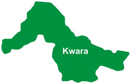
Sambo spoke in Ilorin, Kwara State capital during the opening ceremony of 47th Annual General Meeting of the Nigerian Institute of Surveyors.
The theme of the conference is: "Surveying, Disaster Management and Global Warming."
Represented by the Surveyor-General of the federation, Prof. Peter Nwilo, the vice president said, "our nation recently suffered from an unfortunate air mishap that led to the death of more than 150 people.
"Our inability to avert such incidents and keep our airspace safe is a greater challenge to us as a nation. As we mourn our losses, and resolve to strengthen the mechanics of air safety regulations and inspection systems heighten. We pledge to do everything possible to ensure the safety of lives and property of all Nigerians.
"We all realize that ensuring safety and being positioned properly to manage disasters is predicated on having real-time information on locations and time. This essentially is what maps and its attribute products enable us to do.
"The federal government will do everything possible to ensure that our geographical space is properly and comprehensively mapped.
"The office of the surveyor-general of the federation is being positioned and enabled to perform its rightful roles. It would be complimentary of all state governments do likewise so that in no distant future, our country would possess the spatial knowledge and capacity to take care of all environmental challenges that may arise," Sambo added.
Earlier, the President of NIS, Dr. Yakubu Maikano, said surveying and mapping were the antidotes to the problems of urbanization, inadequate infrastructure and incidences of natural disasters.
His words: "We must be able to accurately monitor our environment so that we can predict occurrence and be able to manage these natural disasters.
"The first step that must be taken to enable us manage our environment very well is the production of accurate maps through length and breadth of this country. Nigeria needs a national mapping policy that will sustain the production of maps in the country."
Cloud Tag: What's trending
Click on a word/phrase to read more about it.
Kwara State Television Bayo Ojo Razaq Ayobami Akanbi Shettima Onilorin Sardauna Of Ilorin Stephen Fasakin Odo-Owa Ahmed Borgu Sa\'ad Alanamu Ilorin Durbar Abdulraheem Yusuf Yusuf Amuda Aluko Madawaki Opaleke Bukola Iyabo Michael Nzekwe Idris Garuba Abdulwahab Ololele Muhammed Akanbi Baba-Isale Kwara Apc Mutawali Of Ilorin Yahaya Muhammad Obasanjo Adesoye College Yahaya Abdulkareem Babaita Oke-opin Shururat Olatinwo Earlyon Technologies IDPU Taofik Abdulkareem Ayo Adeyemi Abdulmalik Bashir Mopelola Risikatullahi Moji Makanjuola Tope Daramola Kwara Basketball Association Lateef Fagbemi Oloye Erubu Sunday Fagbemi Playing Host John Obuh Gbenga Adebayo Siraj Oyewale Radio SBS Aisha Abodunrin Ibrahim SSUCOEN Kpotum Mohammed Baba Ayinde Oyepitan Kwara University Of Education Olugbense Maryam Nurudeen Al-Adaby Ambassador Kayode Laro Akom Construction And Engineering Synergy Ltd Ile Arugbo Razak Atunwa Aishatu Ahmed Gobir Ilorin West/Asa Federal Constituency Afolayan Abubakar Baba Salihu Yahaya Hydro-electric Power Producing Areas Development Commission A.O. Belgore AbdulQowiy Olododo Oke-Odo Abdulrosheed Okiki Ballah Oke-Ogun Taofik Mustapha Ishola Moses Abiodun Sheikh Ridhwanullah El-ilory Alfa Modibo Belgore Abdullahi Biffo Oba-Solagberu Iyaloja-General


